


The Dynamism of the Tokyo Treasure Islands, as Captured by Drone
Eleven Unique Islands, with One Featuring Japan's Only Desert
You probably already know about the territories of the Tokyo metropolis on the main island—the 23 districts in the Tokyo metropolitan area, and the Tama region to the west of it. But did you know that the prefecture also includes eleven islands, scattered in the expanse of the Pacific Ocean? These are comprised of the nine Izu Islands (Oshima Island, Toshima Island, Niijima Island, Shikinejima Island, Kozushima Island, Miyakejima Island, Mikurashima Island, Hachijojima Island, and Aogashima Island) and the two Ogasawara Islands (Chichijima Island and Hahajima Island), located about 1,000 kilometers away from the urban center. Because each of the islands boasts its own "treasure," whether it be a unique natural environment, or a distinct aspect of history or culture, they are collectively referred to as the "Tokyo Treasure Islands."
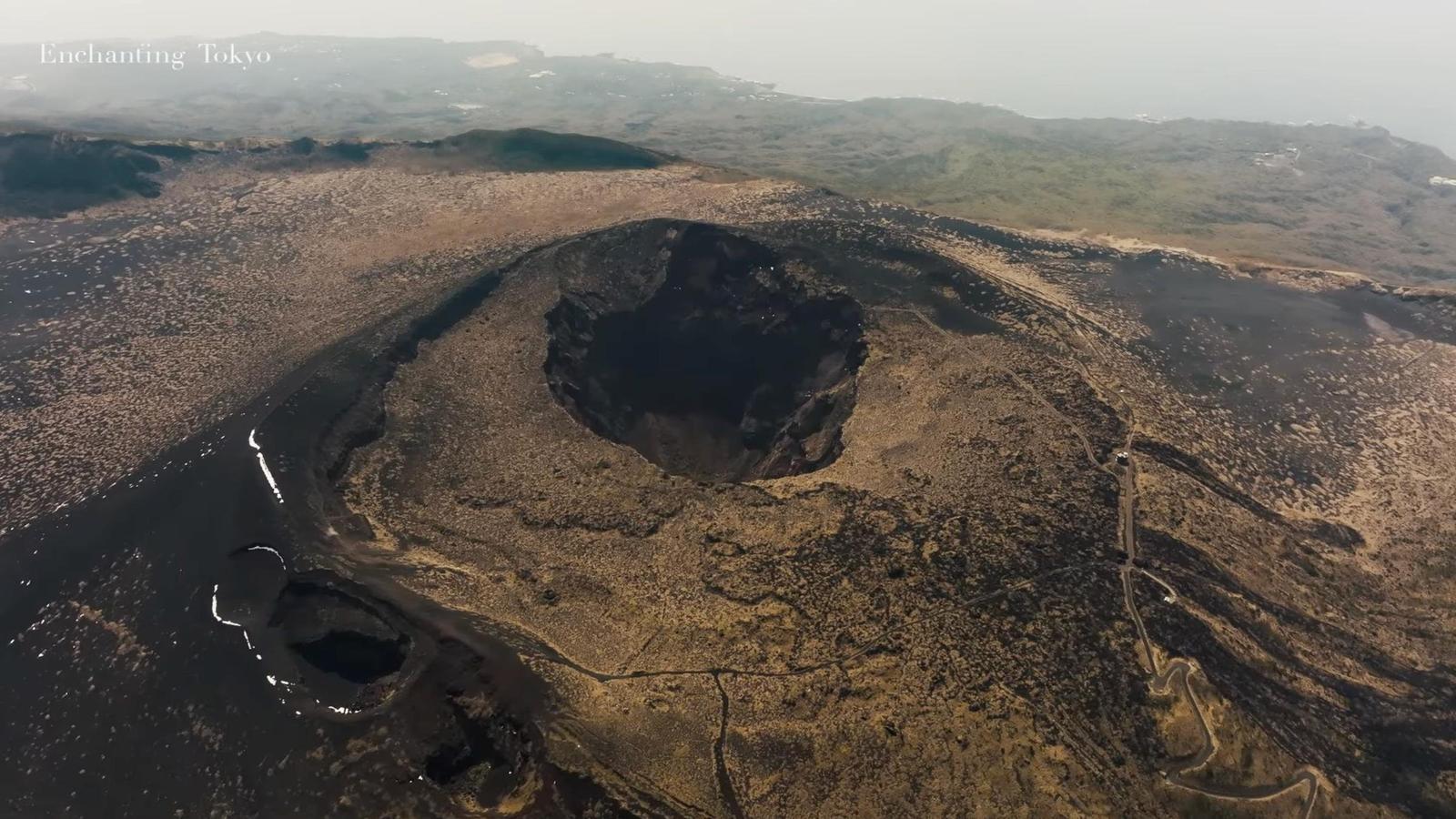
Of these, the one with the largest surface area is Oshima Island, which is located closest to the main island of Japan. The island is actually the "land" portion of an active volcano that emerged from the ocean floor. In 2007, it was selected to be a part of the "100 Geological Spots of Japan," which compiles geological features distinct to the country on a world scale.
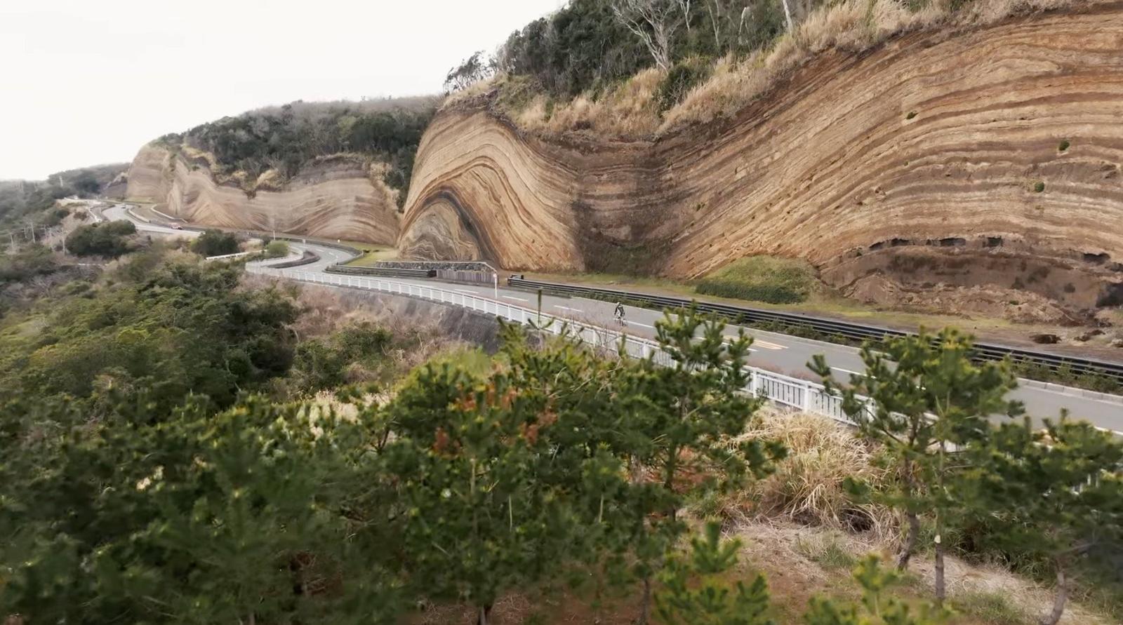
Mt. Mihara, which stands 758 meters tall, is the central volcanic cone in the caldera of the active volcano that is Oshima Island. On the east side of the mountain is Urasabaku Desert, the one and only desert in Japan. In the southwestern part of the island is a rock wall 24 meters tall and 630 meters long—a geological cross-section with a wave-like pattern. Videographer Shiraki Shota visited the island, with its primal feel and raw, exposed earth, and captured its atmosphere in video form.
The Dynamic Scenery of a Volcanic Island
Shiraki, who first visited Oshima for location scouting, says he was struck by the energy and vitality of the volcano. "I learned that the volcano has erupted many, many times over the years, and that with every eruption, the island has changed a little in terms of shape and appearance. It made me feel that this was a very mystical place. I remember being stunned by how dynamic the natural environment was as I went around the island, and it occurred to me that filming the island via drone was probably the best way to capture its real feel."
Shiraki later visited the island again with a video crew, staying on the island for four days to get the footage. The team used aerial drone videography to capture the distinct look and atmosphere of the island, trying a variety of techniques. Shiraki says that while he had seen what the island was like while location scouting, there were things he only noticed once they started filming.
"We found traces of past eruptions all over the island. Byproducts of eruptions, like black sand or solidified magma. Seeing these made the fact that it was a volcanic island feel very real, and I felt overwhelmed by the uniqueness of it."
A Trip to the Island in Video Form
Shiraki says that in order to capture the strength exuded by Oshima Island, they needed the video to have a sense of urgency. The final video, which is about three minutes long, begins with a scene looking down on the Mt. Mihara caldera. Throughout the video, dramatic video angles are interspersed with more subtle compositions, to convey the look and atmosphere of the island in its entirety.
"We wanted there to be clear divisions between the more dynamic portions of the video, and the quieter portions. And it's not just scenery—we also wanted to convey what people could do in this magnificent expanse of nature. So there are scenes with the drone flying right up against the rock wall, and a scene focused on a model in front of a campfire. It'd be great if the video could convey some of the excitement and joy you get to feel on the island to those who've never actually visited before."
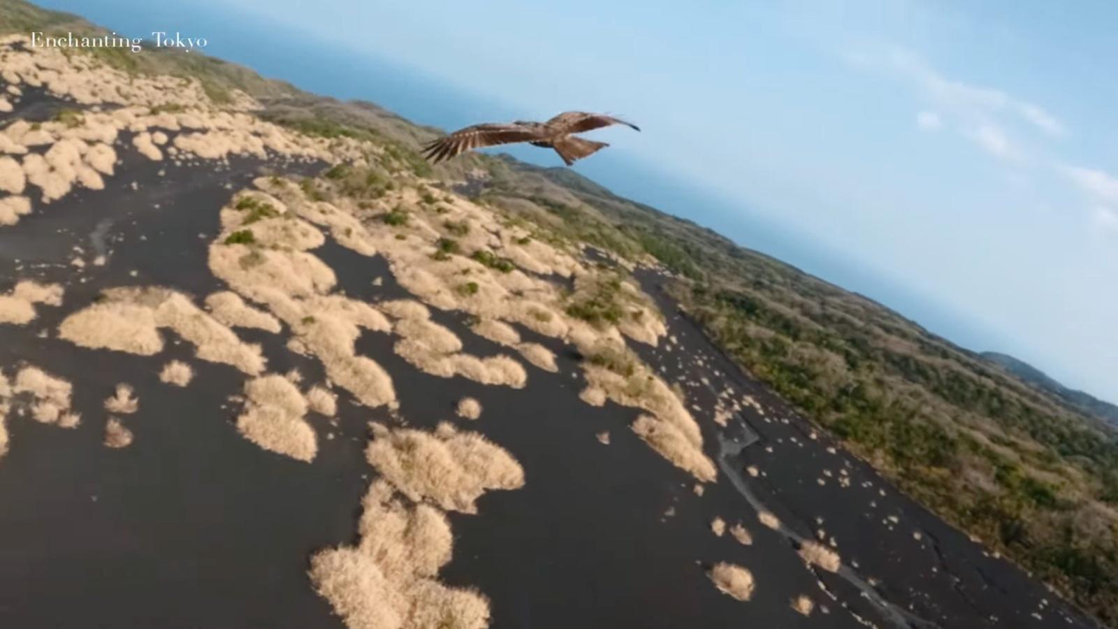
Indeed, outdoor activities like cycling and camping are popular on Oshima Island, given its abundance of nature. The island is also known as "Camellia Island," and is home to Camellia Flower Garden, a vast nature park that cultivates over 100 types of camellias. Visitors to the park are able to admire a wide variety of camellias that are very well-cared for, from ones that bloom in the summer to those that bloom early in the year.

Time seems to pass more slowly on the Tokyo Treasure Islands, with their bounty of nature. Feel for yourself the charm of this "hidden" part of Tokyo, first in video form.
Photos courtesy of Tokyodouga
Translation by Amitt